Identifying flood and climate risk in Australia

MarkNunns
Mark Nunns, an Associate Director of Climate Intelligence at Twinn by Royal HaskoningDHV, brings 15+ years of expertise in flood and climate risk modelling. His mission? Empowering businesses across multiple sectors to build resilience and continuity strategies in the face of climate change. From financial services to logistics and supply chain, and from critical infrastructure to large industrial enterprises, Mark ensures organisations thrive in an ever-changing climate landscape, leveraging cutting-edge climate risk analytics and technology.
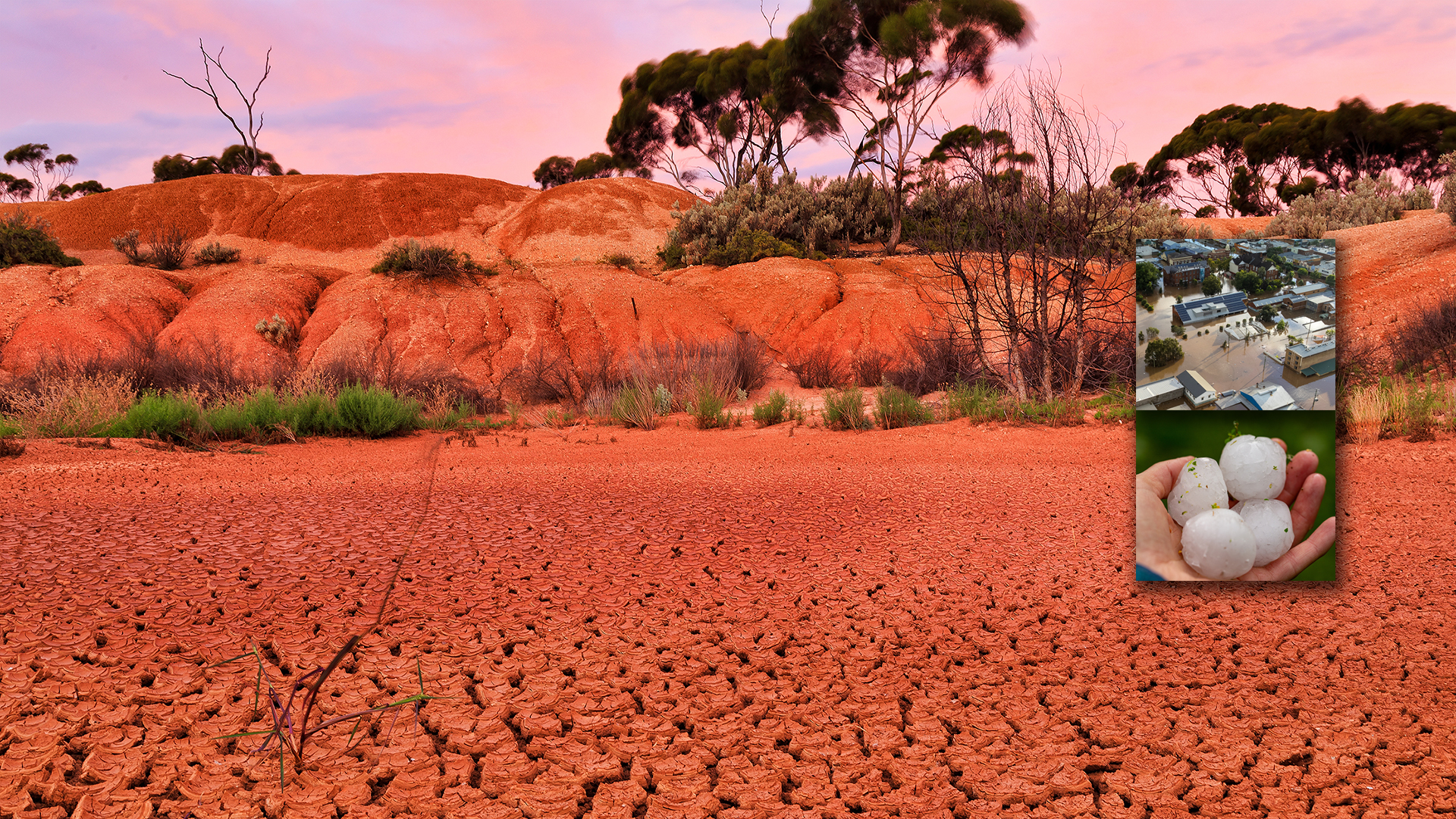
In recent years, Australia has been hit by a multitude of extreme weather events
Flooding, cyclones, hailstorms, bushfires and droughts have wreaked havoc on lives, property and the natural environment. And as the climate crisis intensifies, these climate hazards will increase in frequency and severity.
To identify and mitigate the risk from flooding – Australia’s most expensive natural hazard – governments and businesses are turning to Twinn (formerly known under the Ambiental brand). By leveraging our flood data, climate risk intelligence software and domain expertise, growing numbers of Australian organisations are planning for imminent and future climate events.
An overview of flooding in Australia
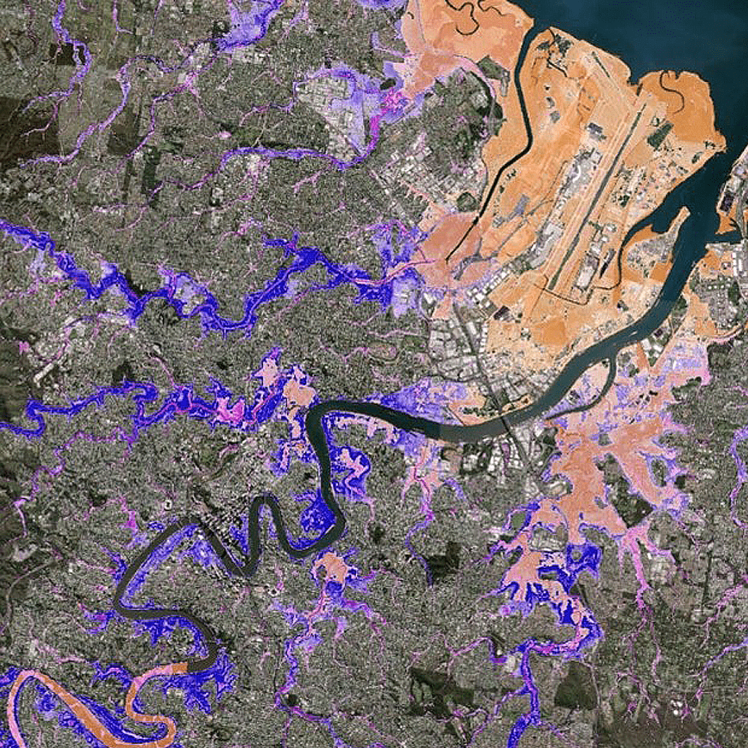
Flooding disasters are Australia’s costliest natural hazard, with Queensland and New South Wales hit most frequently. In February and March 2022, the eastern Australia floods – a series of floods affecting South East Queensland, Wide Bay-Burnett and coastal New South Wales – claimed 22 lives and caused estimated losses of between $1.3 billion and $2.9 billion. To put it into context, Brisbane experienced a record breaking 676.8 millimetres of rain in just 3 days.And this is by no means the first time Brisbane faced major flooding. In 2011, for example, floods caused an estimated $2.38 billion of damage; more accurate flood data could have helped reduce that damage and improve the emergency response.
Identifying flood risk and property risk across Australia
Following the 2011 Brisbane floods, we were tasked with comparing flood profile predictions delivered by the national dataset (used by the Australian government at the time) with our model. The results were conclusive: our model achieved around 95% accuracy compared with 37% with the older dataset. The data we produced during this validation test forms part of Twinn Flood Map – the most detailed and comprehensive view of flood risk and hazards in Australia.Covering Australia’s 7.7 million square kilometres, Twinn Flood Map identifies flood hazards from fluvial (riverine), pluvial (flash flood) and coastal (tidal and storm surge) sources. Modelled using high precision LiDAR topography (where available), we used best-practice techniques to incorporate the latest hydrological data into our model.
Supporting governments and businesses in planning decisions around flood risk
Launched in 2014, Twinn Flood Map has become a key tool for governments, insurers, property developers and emergency response services across Australia, helping them make informed decisions and plan effectively.For example, Twinn now supports around 75% of Australian insurers, and the Government of South Australia uses our data to improve land use planning functions. Prior to our involvement, the government’s understanding of flood risk outside of urban areas was limited; now planning authorities are able to flag development applications where flooding is likely, even in rural areas. What’s more, flood risk awareness is growing across the population and enabling better preparation for flooding emergencies.
In addition to visualising hazards, the government uses Twinn climate risk intelligence to identify and analyse flood risk characteristics for individual properties at a range of geographic scales. We have also been commissioned to produce animations of flood scenarios within key catchments, in order to better understand flood evolution processes.
Constantly updating our flood products to maximise predictive accuracy
Twinn solutions are available through annual recurring licences. Not only does this provide ongoing access to our dedicated support staff and technical experts, but it also means you’ll benefit from the latest updates as soon as they are released. As part of our annual update process, we use major events and customer feedback, adjusting where necessary to improve the predictive accuracy of our model.
Combining market-leading high-resolution coverage with multiple flood scenarios, Australia Flood Map is a core product that is tried, tested and trusted by the market – and one that we’re constantly updating and improving. As part of our annual upgrade process, we use major events and customer feedback, adjusting where necessary to improve the predictive accuracy of our model.
During 2022, for example, we conducted hydrological and hydraulic reviews of multiple high-risk locations, upgrading locations covered by our 30m rural modelling methodology and expanding coverage of our higher resolution 5m urban LiDAR models. Twinn has also conducted extensive research into flood defence schemes in operation across Australia.
Assessing multiple climate hazards now and into the future
Having moved into a La Niña weather system, Australia faces a higher risk of severe storms over the next few years, with risks expanding to encompass wind and hail. However, separating the cyclone component from the normal flood signal is complex, presenting a significant challenge for insurers when it comes to defining policies and pricing risk. In response, we’ve developed a cyclonic risk indexing methodology, which has already been adopted by major insurers.Going beyond flood support, Twinn also provides climate risk intelligence encompassing 19 other hazards – including drought, wildfires, heatwaves, wind and hail storms
Combining this market-leading data with financial services, sustainability and resilience expertise, we're helping Australian organisations understand and mitigate climate and physical risks to plan effectively for the long term.Are you searching for the most detailed and comprehensive understanding of climate hazards facing your organisation, now and in the future? Get in touch to learn how we’ll help you create and implement a climate risk management solution.